Monaco
Monaco
The Rock, harbours and urban gardens
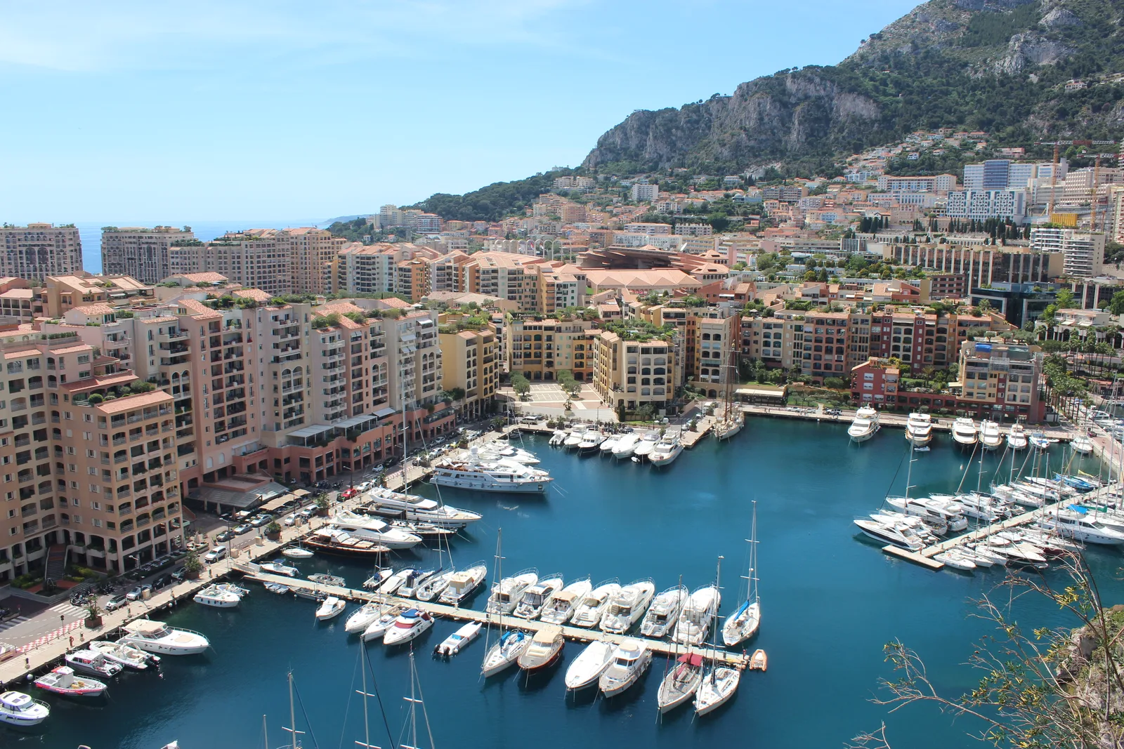
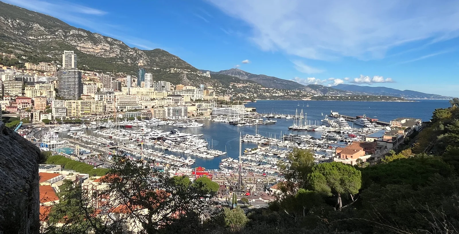
Monaco unfolds across several levels: the historic Rock above the sea, Port Hercule and Fontvieille harbour, Monte-Carlo gardens and the Larvotto waterfront. Exploring the city means considering slopes, steps and public lifts as well as distance.
- State
- Principality of Monaco
- Official language
- French
- Railway station
- Monaco-Monte-Carlo
- Oceanographic Museum
- Opened in 1910
- Princess Grace Rose Garden
- Opened in 1984
Explore the destination
A city on several levels
Public lifts, escalators and moving walkways supplement Monaco’s pedestrian network. They connect streets at different heights, but a short line on a map can still involve steps. For a daily route, check the actual entrance and the connection between levels.
Monaco-Ville and the Rock
The Prince’s Palace, cathedral and Saint-Martin Gardens stand on the Rock. The Oceanographic Museum, founded by Prince Albert I and opened in 1910, occupies a cliffside building. Treat the historic streets as a separate walk, allowing for the climb and checking visitor access to individual places.
Fontvieille: harbour and rose garden
Fontvieille harbour and the nearby park form a distinct part of the coastal city. The park contains the Princess Grace Rose Garden, opened in her memory in 1984. This is a different harbour from Port Hercule, so distinguish the two when planning a waterfront route.
Monte-Carlo and Larvotto
Monte-Carlo’s landmarks cluster around Casino Square, the Boulingrins Gardens and One Monte-Carlo’s shopping spaces. Along the Larvotto waterfront are the beach, Japanese Garden and Grimaldi Forum congress and cultural centre. These landmarks help distinguish urban and seaside settings; they do not establish a view from any particular apartment.
Trains, buses and a harbour crossing
Monaco-Monte-Carlo station connects a rail journey with the city’s walking routes; Place Sainte Dévote is one access landmark. CAM buses serve the principality, while the electric Bateau-Bus crosses Port Hercule. Check timetables and the availability of your intended connection for the day of travel.
La Condamine: changes in 2026
La Condamine’s covered market is undergoing redevelopment in 2026. Temporary trading arrangements mean a familiar description of visiting the indoor hall needs updating. Before shopping, check the current trader locations and pedestrian access around Place d’Armes.
Orientation coordinates: GeoNames · CC BY 4.0. Coordinates reproduced unchanged; this is a city reference point, not a property address.
Monaco: neighbourhoods, routes and coastal life
A practical guide to Monaco’s urban levels, harbours and cultural landmarks.
Assessing a daily route
In compact Monaco, changes in elevation alter what nearby really means.
Read more
Check the change of level
Trace the route from the building entrance to your destination street, including any public lift or steps. Check an alternative in case that connection is unavailable.
Include the station approach
For a journey through Monaco-Monte-Carlo, consider the walk to the station as well as the train ride. Place Sainte Dévote is a useful landmark, but the most convenient entrance depends on your starting point.
Crossing the harbour
The Bateau-Bus crosses Port Hercule. Treat it as a specific connection between this harbour’s shores and check the onward route separately; it is not a service to Fontvieille harbour.
Three distinct urban settings
The historic Rock, Fontvieille and Monte-Carlo offer different starting points for understanding the city.
Read more
Monaco-Ville
Palace Square, the cathedral and Saint-Martin Gardens connect a historic walk on the Rock. Distinguish access to the streets from visiting arrangements at the palace and museum.
Fontvieille
Compare the harbour waterfront with the park and rose garden. A green space in the neighbourhood does not mean every building has equally convenient pedestrian access.
Monte-Carlo
Casino Square, Boulingrins and One Monte-Carlo help explain the shopping and walking environment. For a particular building, check its side of the street, entrance and actual window orientation.
Coast and culture in daily life
Separate landmarks by their purpose: a beach, harbour, garden and museum offer different experiences.
Read more
Larvotto and the Japanese Garden
Larvotto beach, the Japanese Garden and Grimaldi Forum provide several different waterfront stops. Plan around these landmarks without assuming identical access to every stretch of coast.
The museum on the Rock
The Oceanographic Museum is associated with Prince Albert I’s marine research. Its cliffside building and collections make a visit a destination in its own right; check current opening hours and entry arrangements.
Art beyond museum galleries
The Rainier III Sculpture Trail runs through public spaces in Monaco-Ville, Fontvieille and Monte-Carlo. Use it for several shorter walks, selecting a section by neighbourhood and terrain.
What to check in person
A neighbourhood overview helps frame questions about an address but does not replace a building visit.
Read more
Shopping during the market redevelopment
La Condamine’s market hall is being redeveloped in 2026. Do not base a daily routine on the assumption that all traders are inside the familiar building: check the temporary arrangements.
Views and access to the water
A coastal neighbourhood alone does not establish a sea view, beach access or access to a berth. Compare the floor, window orientation and actual walking route with your priorities.
Streets and time of day
Walk your intended route at the time of day you expect to use it regularly. Separately check noise at the windows and access to the entrance; a broad description of Monte-Carlo or Fontvieille cannot describe every building.
Properties in the city
Open map and propertiesPhoto credits
1. Uhooep · Fontvieille harbour, 2017 · CC BY-SA 4.0. Resized, WebP format.
2. Benoît Prieur · Port Hercule seen from the palace, 2021 · CC0 1.0. Resized, WebP format.